
River Rat Musings: The Dynamic Nature of River Deltas
By Fritz Funk
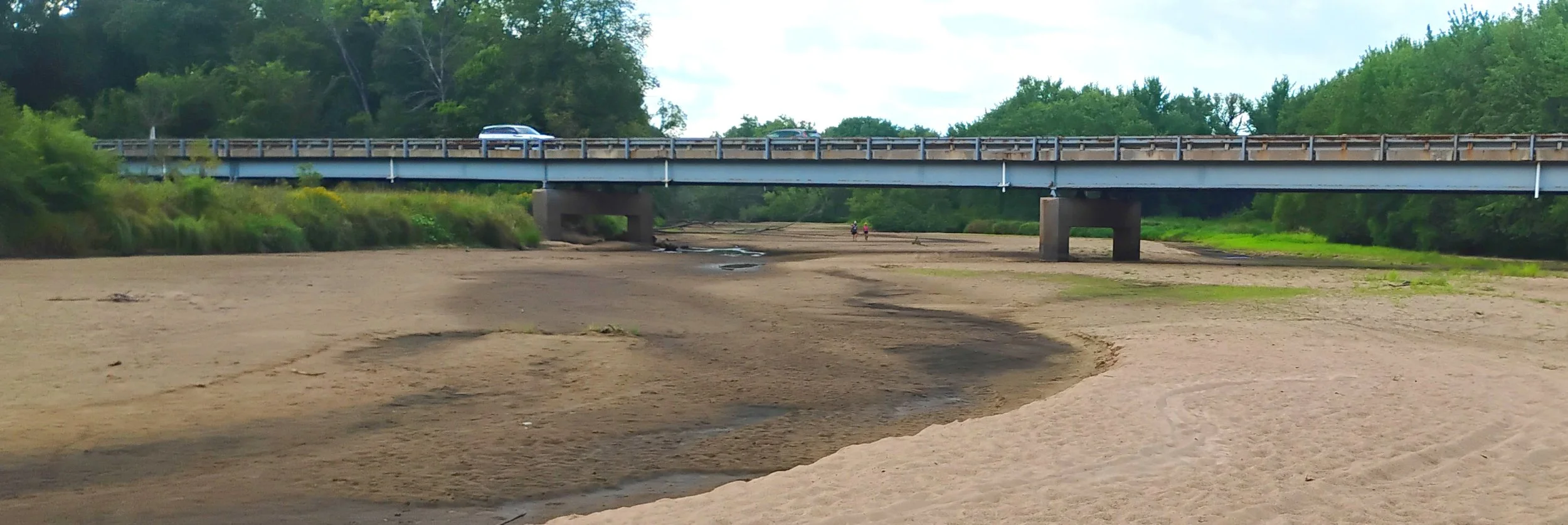
The recently dried-up "main channel" of the Black River under the Highway 35 bridge to Trempealeau. Braided river channels and their deltas are fascinating places because they are always changing, despite humans’ best efforts to control them!
A stark reality check for Black River users happened this summer when the primary channel of the Black River for over 200 years completely dried up! The entire flow of the Black River is now going down the westerly Tank “Creek” distributary channel, emptying into Mud Lake near Trempealeau and then the Mississippi. That left boat landings and a signed canoe trail down from the Great River Trail at Lytles completely high and dry. While this summer’s dried up channel is mostly a natural process, humans have played their roles, starting over 150 years ago.
The Black River delta (inland from river miles 707-712) is one of the few remaining large and reasonably healthy tracts of floodplain habitat bordering the upper Mississippi River. Earthen causeways of the railroads and highway crossing the delta constrain the river’s flow somewhat, but outside of those constrictions, the distributary forks of the river go about their natural shifting meanders, continuously creating new habitat as floods, currents, and sediment shift its channels, islands, and wetlands around.
The Black River delta is my “backyard” and I have followed its changing shapes for most of my 73 years on the planet. Its where I “play”: explore, waterfowl hunt, fish, birdwatch and just hang out for a wild place to chill. My Dad and I had a habit of exploring the delta in detail, especially after any high water, just to see what had changed. Fishing poles usually came along on those expeditions, but were rarely used – exploring wherever we could get our small outboard boat or canoe into was the real goal. I have a fairly good memory of the changes over the years and now augment my boyhood curiosity by spending time researching the river in libraries from Black River Falls to Madison. That delta was a busy place! Since the late 1920s, we also have aerial photographic records of the river’s meandering.
Major human impact on the Black River delta started in 1864, when a consortium of Onalaska and La Crosse sawmill owners, began diverting all of the delta’s distributaries to flow along the Brice Prairie shoreline towards Onalaska. They wanted their logs to go to their Onalaska and La Crosse sawmills, not dump more directly west into the Mississippi River, where they would bypass their sawmills. A dam across the Tank “Creek” distributary was part of the deal. Their dam provided a solid enough base that flow was stopped for over 100 years! In the early 1980s, the Black River finally punched a small hole through that dammed area and the logs that had accumulated on top of it. The flow has gradually increased since then, until this year all the flow at that junction is going down Tank Creek. I remember my Dad commenting in the 1980s that this would happen.
There were other players interfering with the river too. 1870 saw the first of the earthen causeways cross the Black River delta when the Chicago Northwestern railroad’s predecessor constructed what is now the Great River trail, constricting the river’s meandering. This was followed in 1886 by the adjacent Burlington railroad earthen causeway. In 1854, Alexander McGilvray had started a ferry across the Black River, whose access roads slowly developed into what is now the Seven Bridges trail. A new earthen highway causeway across the delta opened in 1953, initially called State Highway 93 (now Highway 35).
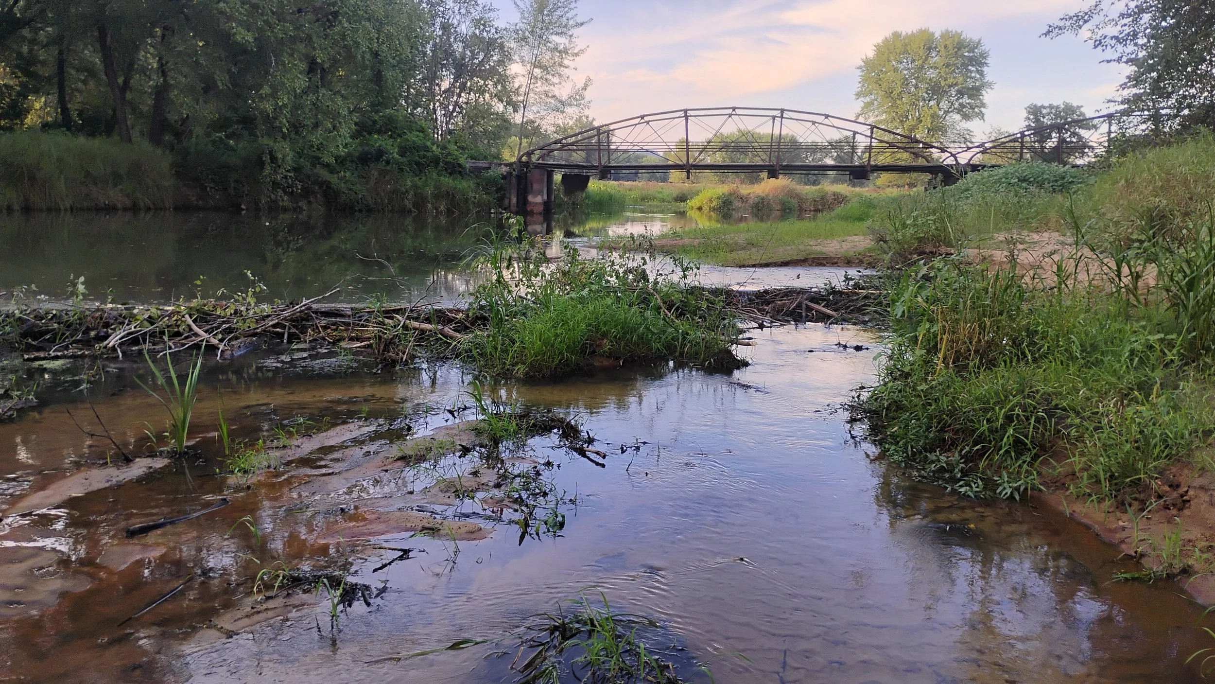
McGivary Bridge. Photo courtesy of Fritz Funk.
These earth-filled causeways constrict where the river can meander: the river’s flow can only go through bridge and culvert openings here and there. When the river tries to meander, it must “jump” a significant distance to the next bridge opening. The limited number of bridge openings make these jumps more abrupt and dramatic, which is just what happened this summer.
While the changing meanders are mostly a natural process, that’s little consolation for the property owners at Lytles and New Amsterdam who are now landlocked, or those accustomed to paddling the Lake Onalaska canoe trail down from Lytles Landing.
Some water still flows through the Van Loon wildlife area, crossing McGilvary road at bridge #4, aided by beavers and nourishing remnant wetlands. Flow through the dried channels will resume periodically during higher water, but is not likely to return to the eastern delta channels until more sediment builds up along the western side of the delta. 150 years of human interference caused sediment to build up along the eastern side of the delta, leaving it “tilted” towards the west. The bedload sediment is mostly natural, the result of the river cutting into glacial sand terraces further upstream. There is, unfortunately, no easy fix to turn back the clock.
